Day three.
Still jet lagged I’m waking up early, so I was one of the first people to eat breakfast. A sleepy Jeremy joined me (the husband from last night) but no sign of his wife before I left. Today’s plan looks easy on paper: 8 mile (13km) with a 2,000 foot (600 meter) climb. I felt cautiously optimistic as I “only” had 13km to walk. How bad could it be?
(Answer: bad. Very, very bad. Also not 13km.)
Apparently this is the rainiest spot in England so true to form, it was drizzling when I took off, but quickly cleared to a gorgeous sunny morning. Since my hotel was one of the first in the little villages I had quite a few km’s to make up before I started to climb,
And climb I did. No rest for the weary. I knew it was 2,000 feet and I could see the top of the mountain in the distance. It was ultimate British weather, sunny and hot one minute, raining the next, windy the next, and during one sunny point I looked back and saw the beautiful valley I had started at. Then I looked ahead at the huge mountain ahead of me. Still had a long way to go. Sigh…..
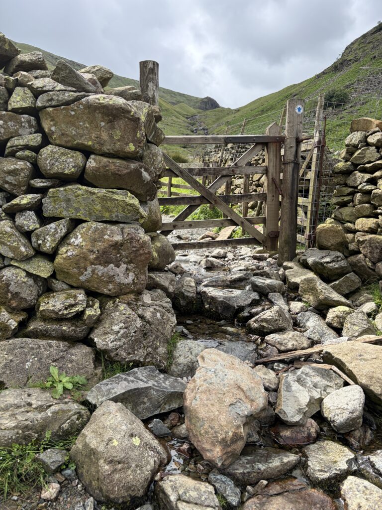
At one point the super fit guy from yesterday who told me the stone steps “were steep but quick,” caught up to me.
“You!” I said accusatorily when I saw him. ” ‘It’s steep but quick'” I said mocking him. “Sure! For you! It took me over an hour! It was a total nightmare” I jokingly complained. He and his partner laughed as well, “Then I better not tell you what is coming up today!” he said. “I can see what’s coming today,” I grumbled pointing up at the peak of the mountain we were midway through. They wished me good luck and then took off, absolutely zooming up the mountain.
As I climbed higher and higher it was rainier and foggier and I lost sight of the valley below me. I also could see the mountain path better as I got closer and I realized that while I was focused on the big rolling mountain before me, my actual destination was this incredibly steep and tall peak. I had to go up that?!

The funny thing is this whole time I had been telling people the Coast to Coast wasn’t crazy like the Appalachian Trail. “I won’t be using my hands climbing over boulders and up mountains,” I specifically recall was the line I used several time. And yet, as I looked up this sudden steep climb on the side of a mountain I realized that is exactly what I would have to do.
I took a protein bar break before attempting the climb and somehow, everyone I had met over the past few days caught up with me and we all tackled this mountain together. The Kiwi cousins, the couple from last night, even a brother sister team who I had briefly talked to the day before. They were doing a 50th anniversary hike of their first Coast to Coast in 1976. I thought they were joking because they looked my age, but turns out they were four and eleven 50 years ago the first time they did it. 4?! 11?! Their parents were crazy! But they had all their old pictures and they were recreating them as they went along.
Anyway, back to the terror and the fear of climbing up the side of the mountain. I was at the rear of the group but all I can say is THANK GOD for everyone else. Because it was very scary as the path was basically a vertical climb on muddy slippy rocks. I was so scared I was gonna fall and glad there were people around to help me if needed. At some points I had to use my hands to grab the rocks ahead and lift me up because it was so steep. Not only was it physically difficult but emotionally as I was petrified because I had never done anything like this before in my life, and had no real idea what to do except get to the top as quick as possible.

I managed not to slip and basically collapsed at the top to catch my breath. Everyone except the bro/sis had already moved on, because we weren’t even at the peak yet, and I really should have enjoyed getting to that height and taken pics and appreciated the moment but I was just so frazzled, and knew I still had more to climb, I just went on.
Luckily the way to the actual summit was easier on a normal path and after I reached the peak and started walking down I heard someone call my name. It was the Kiwi cousins who were taking a break sheltered from the wind behind a rock.

I joined them and we ate snacks and chatted, our butts getting soaking wet from the tall wet grass we were sitting in. Still fun though. They left first and then I started my descent, a very long way down on a sometimes steep trail filled with sheep and sheep poop. I clutched my poles and had to calculate where to put my foot on the irregular rocks for miles. It was exhausting to focus so hard.
I could regularly see the cousins in front of me and again I was relieved that they were in “shouting distance” in case something happened to me. I really didn’t expect this hike to be as technically difficult as it was and I never expected to be so scared about falling and hurting myself. Was doing this myself the best idea?!
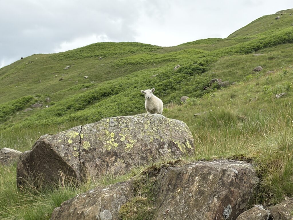
The path finally leveled out and the last few miles were easier. But at this point I was exhausted. I had to take a break less than a mile from my hotel just because I was too tired to keep going without a small rest.
I finally arrived into the cute little town of Grasmere-one of the places I most looked forward to visiting- and my B&B was especially adorable in the center of town so I was excited to be there. But it was too late and I was too tired to explore so it would have to wait until tomorrow.

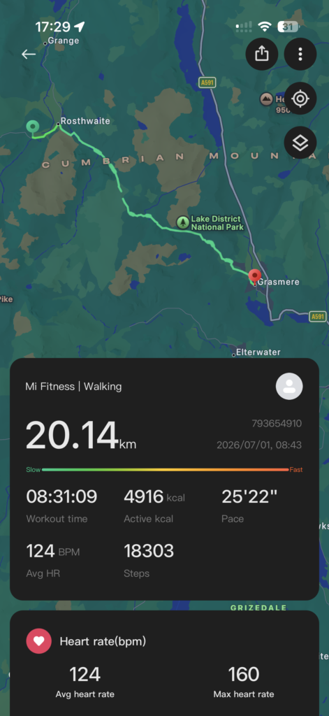
I ended up doing 12.5 miles (20km) in 8.5 hours, much more and longer than I expected. I feel like the trail map isn’t exactly accurate and is tricking me into thinking I have easy days.
Leave a Reply